

6 Day Backpacking Trip on the John Muir Trail

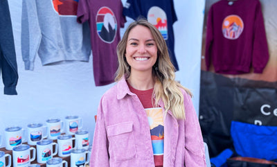
At Human Nature Designs, we believe the best inspiration comes from time outdoors. As a Colorado-based designer and national parks travel shop, every sticker, camp mug, and travel print in our collection is rooted in adventures like this one: my 6-day backpacking trip on the John Muir Trail (JMT).
I recently headed out on the John Muir Trail (overlapping with the Pacific Coast Trail) for my very first backpacking trip, which turned out to be one of the most beautiful nature-filled experiences I’ve had in recent memory.
We started in Mammoth Lakes and ended in Tuolumne Meadows in Yosemite National Park. I logged our mileage, created a map of our route, and took some pretty incredible photos - all of which I have included in this blog for those who are looking for their next backpacking adventure!
If you’re planning your own Yosemite backpacking trip or looking for your next national park section hike, here’s a day-by-day breakdown of the route, plus tips to help you prepare. And if you love bringing pieces of your adventures home, be sure to check out our Yosemite National Park Gift and Souvenir Collection.
Mammoth Lakes > Tuolumne Meadows
- Total Miles: 46.7 mi
- Total Elevation Gain: 7575 ft
- Total Time: 6 days
_____________________________________________________________________
DAY 1: Agnew Meadows > Ediza Lake
- 7.8 miles
- 1,512 ft gain

Tip: The easiest way to get to Agnew Meadows from Mammoth Inn is via the Devil’s Postpile Shuttle, which is a cheap and quick ride that drops you off directly at the Agnew Meadows trailhead. From there the journey begins! Tips: stop for a swim and lunch at Shadow Lake - there is a beautiful area where the water is deep enough to jump in.
We camped at Ediza Lake for our first night, which is an idyllic (and slightly crowded) camping spot for many hikers and backpackers.
Souvenir Idea: Remember your first evening by the campfire with our Yosemite National Park Insulated Camping Mug.
DAY 2: Ediza Lake > Thousand Islands Lake
- 8.5 miles
- 1,745 ft gain

DAY 3: Thousand Islands > Rush Creek
- 5.3 mi
- 1,017 ft

DAY 4: Rush Creek > Lyell Canyon
- 9.8 miles
- 1,166 ft gain

Tip: This part of the trail heads over Donahue pass at 11,000 ft, which can be dangerous in the afternoons due to thunderstorms and lightning. Be sure to head over the pass early in the morning, which will give you the best chance of beating the storms!
In the photo above, you can see the Lyell glacier, which is the largest glacier in Yosemite and second largest in the Sierra Nevada. The below photo shows the dramatic ice loss since the 1800s. The glacier is incredibly important to the local ecosystem, as it feeds the majority of the water sources in the area.

You can read more about the glacier and its retreat here.
We ended up going a little farther than our map suggested for a camping spot, which helped make our hardest day in terms of elevation (day 5) a little shorter.
Souvenir Idea: Our Yosemite National Parks Keepsakes are a a way to remember these landscapes—and to give back, since every purchase supports conservation through 1% for the Planet and Brands for Public Lands.
DAY 5: Lyell Canyon > Fletcher Lake
- 8.2 miles
- 1,906 ft gain

The original plan on our map was to stay at Fletcher Lake, which is an option many campers choose. However, we ended up going off route a bit and camping at Boothe Lake. It took a bit of navigating, but ended up being well worth the peace and quiet.
Tip: stop at Evelyn Lake's sandy beach for lunch! We all agreed this area looked like Mars (very different than the rest of the trail) - a flat and open area with a bunch of scattered boulders.

On this part of the trail, you will pass by Vogelsang High Sierra Backpacker's camp - the highest of the High Sierra camps in Yosemite.
DAY 6: Boothe Lake > Tuolumne Meadows
- 7.1 miles
- 229 ft gain

The final day was our easiest one! It was almost entirely downhill, so we got an early start so we could finish up by lunch time. While it was only 7 miles, this part of the trail definitely felt grueling as we were so close to a cold beer, a big sandwich, and a long shower.
My Maps & Stats


- Best Section Hikes on the JMT
- A Complete Guide to Hiking the JMT
- JMT Backpacking List - REI
- Yosemite's Glaciers
And if you want to bring the trail home, explore our Yosemite National Park Gift Shop. From stickers for your water bottle to mugs for your campsite coffee, every piece is designed by a national parks designer who’s walked these trails—and every purchase gives back to Mother Nature.


Leave a comment